This article provides details on all the wonderful things to do in Montaña de Oro State Park.
Have meteorologists given you misleading information?
I think it has happened to all of us.
One of my most notorious “weather.com fiascos” took place during one of my Central Coast getaways. Based in Morro Bay, I checked the weather forecast before breakfast. The sun was supposed to be in full force by 10:00 a.m.
At 10:00 a.m., it was still dark, cold, and foggy. I checked the forecast again. At that moment, the sun was supposed to show up at 11:00 a.m. At 11:00, Morro Rock was still covered in dense mist and not a beam of light was on sight. At that moment I faced the truth, the sun was never going to come out (even though the forecast said it was going to appear at 12:00).
I was so obsessed with the weather because I had planned an all-day hiking itinerary, including an ascent to Black Hill, a high point from where the entire Morro Bay area is visible. And, yes, I wanted tons of well-lit photos!
As grumpy as I was, I decided to move ahead with the initial part of the plan. We took Main Street which promptly turned into State Park Road and South Bay Boulevard. The car passed through streets following the serpentine turns of a bay formed by a 5-mile sandpit.
We passed Morro Bay State Park and other preserves with splendid names such as Elfin Forest, Sweet Springs, and Heron Rookery. Once we left behind the unincorporated area of Los Osos, the sign for our final destination appeared followed by warnings about deer and people horseback riding.
Table of Contents
Montaña de Oro State Park
We made it to Montaña de Oro State Park and I wasn’t happy at all. The light was still minimal and small drops of rain started to cover the windshield. I told my husband: “You know, let’s go back to Morro Bay and find something else to do”. I was so focused on my negative attitude that I was discarding all the “must-see”, “don’t miss” and “if you only do one thing” recommendations about the park.
As we were returning, my husband told me: “At least, we should take a look at one of the places the lady at the visitor’s center recommended”.
That is when things took an abrupt change. I realized I have entered a wonderland of bluffs, coves, terrestrial and marine creatures, arches, caves, wildflowers, birds, and even reptiles (it was not fun to encounter a snake).
My attitude almost made me miss one of the most beautiful state parks in California! I said “No more complaining,” and proceeded to enjoy the rest of the day at the park.
What I recounted was my first visit to Montaña de Oro. After that “almost tragic” day, I have been many times.
I still believe this is one of the beautiful parts of the Californian Coast. I am providing plenty of details to encourage you to visit the park.
About Montaña de Oro
Montaña de Oro means “Mountain of Gold” in Spanish. The state flower, the California poppy, is responsible for the name. During spring, the vibrant orange flowers cover dunes, coves and mountain skirts with an incandescent hue.
The park consists of 8,000 acres (32 km²) of cliffs, sandy beaches, coastal plains, streams, canyons, and hills, including the 1,347 ft (411 m) Valencia Peak. The park has many hiking, mountain biking, and equestrian trails, as well as a campground located across from Spooner’s Cove, a popular beach.
The entrance to the park is free. This is a big plus!
Montaña de Oro is located roughly between Los Angeles and San Francisco (220 miles). Visitors base themselves in one of the cities in San Luis Obispo County (Morro Bay, Pismo Beach, San Luis Obispo, Paso Robles). The park is a great stop on a CA-1 or Pacific Coast Highway road trip.
Sand Spit Road
Before entering the actual park boundaries, I recommend turning left at Sand Spit Road.
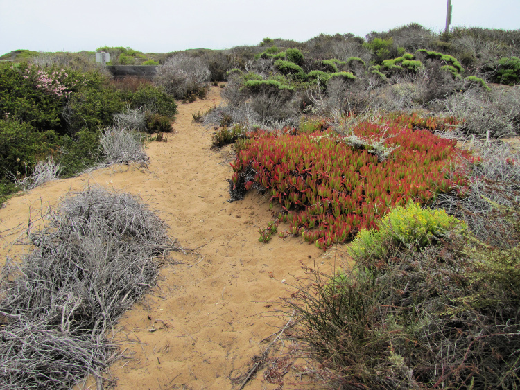
A short hike takes you to a sand dune ecosystem and to Sand Spit Beach. From here, you have access to the sand spit or outer arm that forms Morro Bay. Some people walk to the mouth of the bay (about 4 miles one way).
I love this area since I have observed wildflowers and dolphins playing in the surf. The views of Morro Rock are great too.
Hazard Canyon
A short drive south of Sand Spit Road (pass the eucalyptus grove), you will find the Hazard Canyon parking lot.
A trail will take you to a stunning piece of coastline. Since there is a reef in the area, this is a prime spot for tide pooling. Walking to the Sand Spit Beach is possible (1.5 miles). However, a lot of people bring sleds to play in the sand (the same sleds used for the snow, work in the sand).
Spooner’s Cove
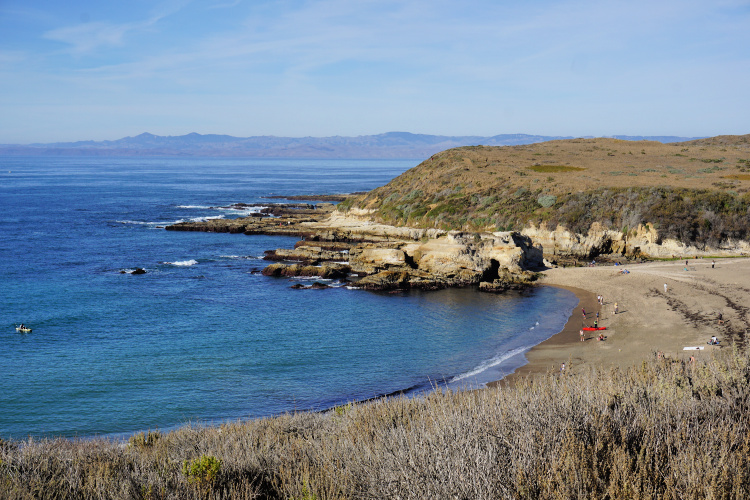
My jaw drops every time I arrive at Spooner’s Cove. This crescent-shaped beach backed by cliffs is a hit with visitors. You can explore the rock formations, check out the tidepools around the mouth of the Islay Creek or bask on the sun.
Facilities include restrooms, potable water fountains, picnic tables, and two large parking lots. Dogs are allowed on-leash.
This is where the park’s headquarters, Spooner Ranch House, is located. Here, you will find a museum, gift shop and general store.
Montaña de Oro – Bluff Trail
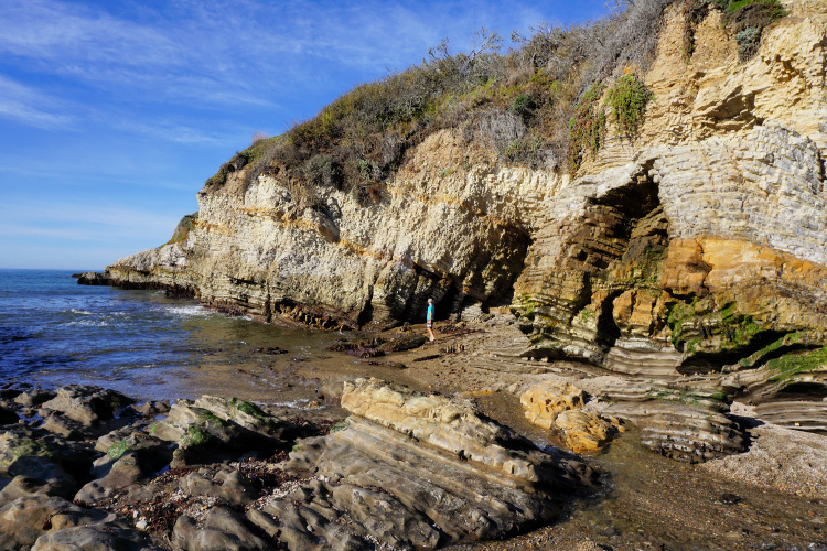
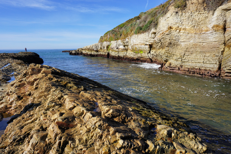
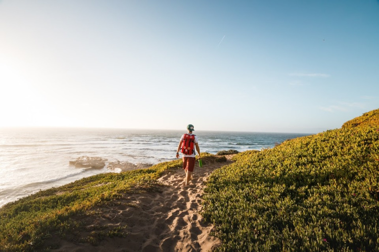
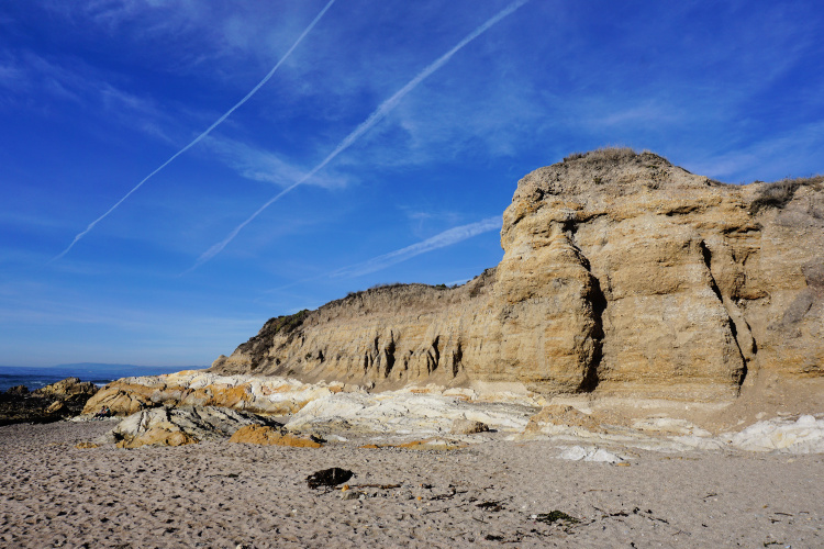
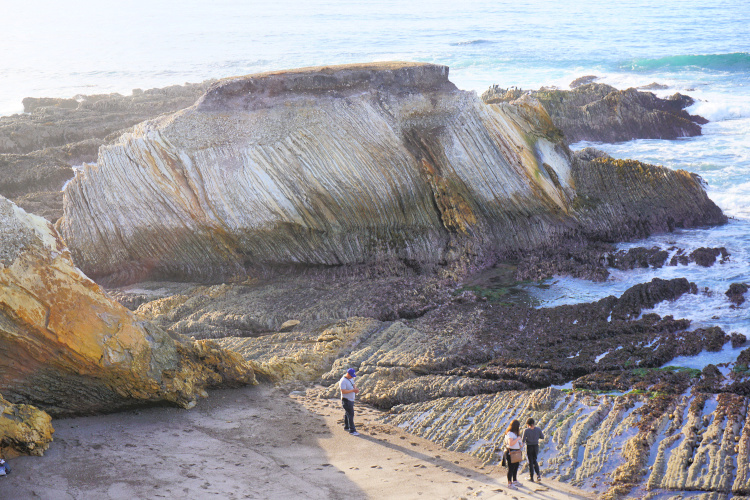
Probably, the Bluff Trail is the most popular walk in the park. As the name suggests, this trail allows you to appreciate most of the park’s rugged coastline. Get ready since the forces of nature created surreal formations here. There is an abundance of arches, pinnacles, and caves.
Also, keep in mind this is an undeveloped place. If you think about it, this is a rarity in overdeveloped coastal California. The park gives you a glimpse of how things have been for hundreds of years.
The Bluff Trail has a 3.4-mile length (round trip). This easy trail can be accessed from the Spooner’s Cove area. You will notice people walking towards the trail.
It is advisable to make time to walk at least part of the trail. If you are pressed for time or visiting with kids (or you just don’t like to hike/walk), walk the part of the trail between Spooner and Corallina Coves. This half-mile portion (one way) will show you what this part is all about.
Corallina Cove
As mentioned in the previous section, Corallina Cove is accessed through the Bluff Trail. This is another beautiful beach surrounded by amazing rock formations The tide pools here are full of marine life. Signs posted in the vicinity give you an idea of what creatures to look for. Take your time to explore.
Other Hikes
Those looking for more challenging trails can find those in the backcountry part of the park.
Valencia Peak Trail – 4.5 miles, round trip. Offers 360-degree views from the top of Valencia Peak
Hazard Peak Trail – 6 miles, round trip. This is another trail offering 360-degree views from the top but it is considered a bit easier to conquer when compared to the Valencia Peak.
Islay Creek Trail – 6 miles, round trip. This trail takes hikers to a small waterfall.
Oats Peak Trail – 10.5 miles, round trip. This strenuous trail offers views of the Irish Hills, Morro Rock, and the coastline all the way to San Simeon.
Reservoir Flats Trail – This two-mile loop takes hikes to an empty reservoir and a forested canyon.
All these trails can be completed using a mountain bike.
Camping at Montaña de Oro
The park has a campground with 47 sites for tents, trailers or motorhomes. The campground is primitive, meaning that there are no electrical connections or faucets. Each site has a table and fire ring. Potable water fountains and simple toilets are shared among campers.
Reservation to camp can be made through the Reserve California website.
Do not worry if you cannot find a site inside Montaña de Oro. The area is full of camping options. You can check availability on the following places:
- Morro Bay State Park
- Morro Strand State Beach
- Morro Dunes RV Park (has some tent sites)
If you are traveling with an RV or trailer, take into consideration the following:
Nearby Attractions
Point Buchon – The Point Buchon Trail is accessed from Montaña de Oro. In order to do this, you need to drive to the end of Pecho Valley Road, the park’s main thoroughfare. Once there, leave the car on the designated parking lot and cross a small gate. You need to sign a paper releasing the land’s owner of responsibility. The views from the trail are breathtaking.
Elfin Forest – This natural area protects a pygmy coastal oak grove, and other habitats such as coastal sage scrub, maritime chaparral, coastal dune scrub). There are great views of the Morro Bay estuary and bay. This is a nice place for a morning walk.
Morro Bay State Park – The park offers visitors hiking trails, a natural history museum, access to the water and campsites. A concessionary, offering rentals for aquatic activities, is located on-site.
Morro Bay – The city of Morro Bay offers a wide range of attractions. There plenty of beaches, museums, restaurants, and shops to enjoy. Of course, do not miss getting as close as possible to Morro Rock.
Cayucos – This small town, located about 5 miles from Morro Bay, has a wide beach, pier, and tide pools. I recommend eating smoked fish tacos at Ruddell’s and cookies at the Brown Butter Cookie Company.
More of SLO County
There is way more to see in the San Luis Obispo post. I have several articles on specific spots. Feel free to check them out.
Ragged Point: The Gateway to Big Sur
Piedras Blancas and the Elephant Seals
I want to bang my head against a wall every time I remember how I also missed the opportunity to explore one of California’s most beautiful parks.
Lesson: Accept what you cannot control and make the most of every moment.
What do you think of Montaña de Oro? Is this a place you would like to visit?
Pin for later!









UnwireMe says
Amazing place!
Great pics 🙂
-Rich Polanco
Ruth says
Thanks Rich.
Elizabeth says
This is perfect! I am in San Francisco, so Morro Bay sounds like a great idea for a weekend escape during these quarantine days. Thank you for providing so much detail.
Amanda OBrien says
I had never heard of this park – but wow your photos are stunning and Montana is now on my list!