There are many stunning trails to take if you’re interested in hiking in Pismo beach. Keep reading to learn more about each one of these unique tracks!
With its beautiful beaches, sand dunes, monarch butterflies (in season), nature preserves, campgrounds, and stunning pier, Pismo Beach is adventure central.
And, if we are talking about adventure, let me assure you hiking in Pismo Beach is as good as it can get, as the location has many trails suitable for people of all ages and life stages (singles, couples, and families with children and furry friends).
But which of the hiking trails should you take? In this article, we round up the most popular Pismo Beach trails so you can find the right one for you!
Please note: This article contains affiliate links, meaning I may earn a commission if you make a purchase by clicking a link. Of course, this comes at no extra cost to you and helps me to keep offering solid information to readers.

Table of Contents
Hiking in Pismo Beach
Alright, before we get deep into the article, let me clarify the article highlights hiking trails in or near Pismo Beach. Some hikes may fall within city limits while others fall in nearby cities or unincorporated communities.
The idea is to use Pismo Beach as a base. We love to hike and explore in the morning/afternoon and return to Pismo Beach for dining, drinking, shopping, and chilling next to the beach.
Most of the trails discussed here are less than 10 miles from the city center.
Now get ready to uncover the best trails Pismo Beach has to offer.
Pismo Preserve
Distance from Pismo Beach: 1 mile
The Pismo Preserve offers 11 miles of trails on 880 acres of land.
The 5.2 miles Discovery Trail gives hikers of all levels a great overview of the preserve since the trail loops around the vast majority of the areas open to the public. You’ll get to enjoy amazing coastal views ranging from Pismo Beach to Avila Beach. In addition, you will be able to explore canyons, hills, and oak woodland. This is a moderately challenging route that takes around 2 hours to be completed.
The Spring to Spring is a 3.7-mile trail that takes around 1.5 hours to be completed. It’s considered a route for beginners, so people of any fitness level can enjoy the trail. This is a shorter loop around the preserve ideal for those wanting to get a good taste of the surroundings while covering less mileage.
The Vamonos Canyon Trail is 1.3 miles long and takes 35 minutes to be completed. This is a good option for those traveling with kids but still wanting to be rewarded with stunning views.
We recommend going early in the morning, as the Pismo Preserve can quickly get busy. Dogs are welcome, but you must keep them on their leashes!
Note: Trails close when wet. Keep an eye on weather conditions (mostly Nov-Mar).

Pismo Dunes Trail
Distance from Pismo Beach: 2 miles
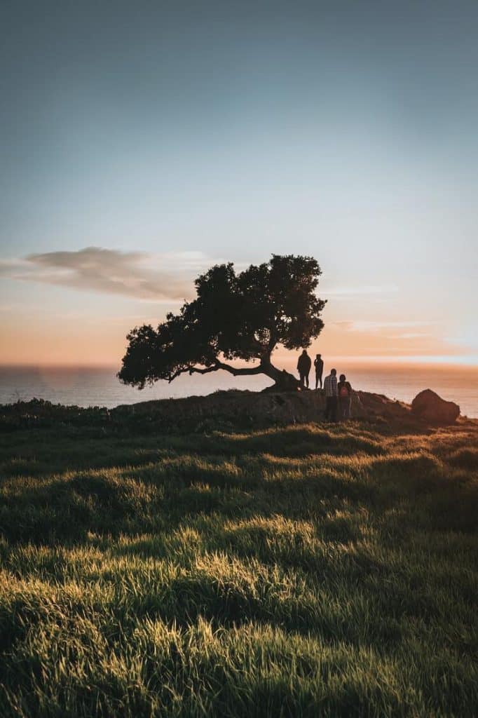
The Pismo Dunes Trail (or Oceano Dunes Preserve Trail) runs for 2.4 miles (round trip) and takes about an hour to be completed. The track is open for visitors all year long, whether you’re a hiker, birdwatcher, or horseback rider!
The trailhead can be found at Grand Avenue, across the Grover Beach Day Use Area. You will see others walking toward the trailhead since it is popular with visitors
Get ready to encounter dancing sand dunes, ocean views, and even wild wildflowers along this trail. You can also bring along your furry friends, but they must be kept on a leash.


Guiton Oceano Lagoon Trail
Distance from Pismo Beach: 3 miles
The Guiton Oceano Lagoon Trail is 1.5 miles long. It is considered an easy trail and takes about 30-45 minutes to complete.
The trailhead can be found at Pier Avenue, close to the Oceano Dunes Visitors Center. It is possible to connect to the Dunes Trail (discussed above) from the roads located close to this trail. Consult a map if you are interested in extending your hike (and exploring the dunes as well as the lagoon in the preserve).
Meadow Creek Trail
Distance from Pismo Beach: 1.2 miles
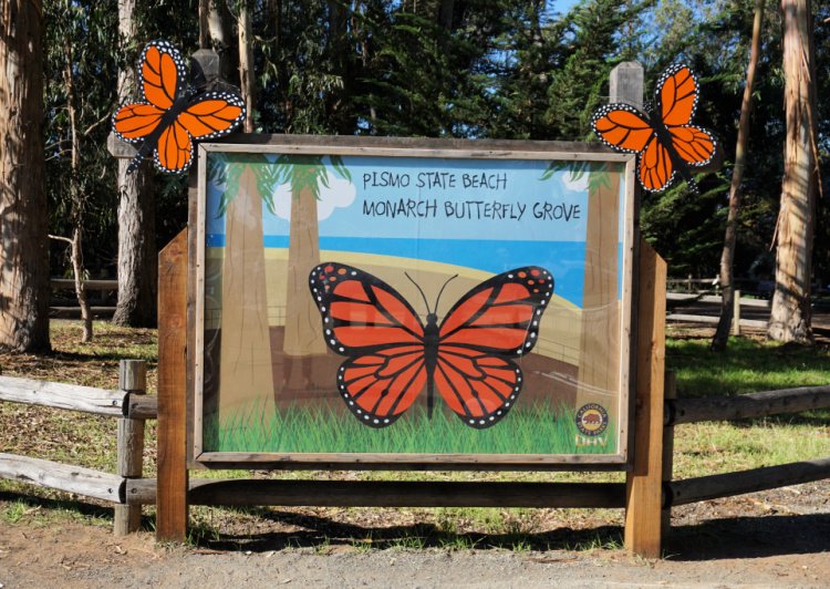
Meadow Creek Trail is one of the most popular places to hike in Pismo Beach since it connects to the Monarch Butterfly Grove (that is why the trail is sometimes known as the Monarch Butterfly Grove Trail).
From October to February Monarch butterflies rest from their long migration at the eucalyptus trees of Pismo.
In season, you can observe the butterflies fluttering all around and stopping over several objects (fences, benches, etc.) As you may know, these butterflies cluster by the hundreds in branches.
Volunteers set up telescopes so you can observe the clusters high up on the trees. The perspective from the lens is incredible. This is a must-see in the area. You learn a lot about these fantastic creatures. In addition, volunteers offer tips on how to protect the migration of the monarch butterfly, one of the greatest spectacles on Earth.
Meadow Creek Trail is 1.5 miles in length. During spring, you can see many types of wildflowers while you walk. Wonderful views of the ocean are on display all year round.
This trail is considered perfect for families with children, as it suits all fitness levels.


Dinosaur Caves and Margo Dodd Parks
Distance from Pismo Beach: 2 miles
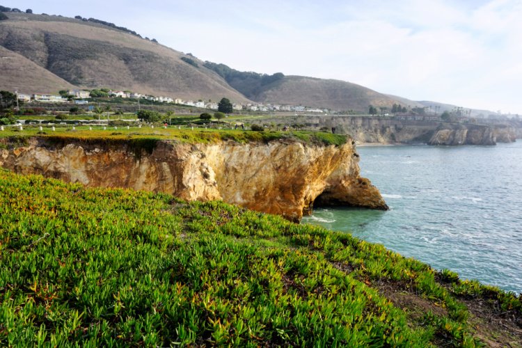
These parks are not necessarily known as hiking destinations but I have to include them in this list because they have some of the more breathtaking coastal scenes of San Luis Obispo County. This stretch of coast is full of promontories, coves, caves, arches, and wildlife (otters, sea lions, seals, and birds).
Start by parking your car at the Dinosaur Caves Park. From there, you can walk along different trails toward different viewpoints. The views are incredible. Get prepared to take tons of photos. The trails are suitable for all ages since they are short and flat. It is a great place to take kids (there is a playground) and pets.
Continue walking towards Margo Dodd Park (you are going to see the gazebo). From this point, you are going to see one of the more iconic views of the Central Coast. It is a joyous scene of rocks, arches, and colorful cliffs. You can get closer to the action by using the stairs located a few meters north.
You can walk as much as you want. I would say you can see a lot by walking a mile or less.
Read More: Shell Beach California


Shell Beach Bluff Trail
Distance from Pismo Beach: 5 miles
The Shell Beach Bluff Trail is a short and easy hike that offers stunning views of the rock formations, coves, and other ocean features between Pismo Beach and Avila Beach. The trail is just under a mile long and takes hikers through a residential area and along a bluff that overlooks the ocean.
From Pismo Beach, the trailhead is located close to the intersection of El Portal and Indio Drives in the Shell Beach Neighborhood. The parking lot is labeled as “Cave Landing Trail Parking” in Google.
From Avila Beach, the trailhead is located at the end of Cave Landing Road. The parking lot is labeled as “Pirate’s Cove Beach Parking” in Google.


Sycamore Crest Trail
Distance from Pismo Beach: 6 miles
Sycamore Crest is a 1.5 miles trail with an elevation gain of 498 feet (you will be climbing a hill). The trail is located near Avila Beach and is considered moderate in difficulty.
The trailhead can be found behind the Sycamore Springs Resort. At the top of the hill, you can enjoy spectacular views of the northernmost section of the San Luis Obispo Bay and Avila Valley. Dogs are welcome but must be kept on a leash.
From this trail, you can connect to the Ontario Ridge and Bob Jones Trails (see below for more info).
Ontario Ridge Trail
Distance from Pismo Beach: 5 miles
The Ontario Ridge Trail is a 4.5-mile out-and-back trail located in Avila Beach. The trail crisscrosses an undeveloped promontory and offers views of the Pacific Ocean, San Luis Obispo Bay (from Port San Luis to Pismo Beach), and Avila Valley. The trail is considered moderate in difficulty and popular with hikers and mountain bikers.
From Pismo Beach, the trailhead is located close to the intersection of El Portal and Indio Drives in the Shell Beach Neighborhood. The parking lot is labeled as “Cave Landing Trail Parking” in Google. This is the same area from where the Shell Beach Bluff Trail is accessed. As a matter of fact, you can hike the two trails as a loop.
There is another trailhead close to the intersection of Shell Beach Road and Avila Beach Boulevard.
From Avila Beach, the trailhead is located at the end of Cave Landing Road. The parking lot is labeled as “Pirate’s Cove Beach Parking” in Google (again, same as for Shell Beach Bluff Trail).


Bob Jones Trail
Distance from Pismo Beach: 6 miles
The Bob Jones Trail is a 3-mile (one-way), well-paved, mostly flat path connecting Downtown Avila Beach to the area behind the Avila Valley Barn.
You will find the trailhead (and parking lot) on Ontario Road (after passing the KOA Campground). The trail ends close to the main pier. Or, you can park in town and start walking in that direction. As an alternative, the path can be completed by bike.
The trail is suitable for children and those in a wheelchair or using mobility equipment.
Note: The Bob Jones Trail’s official name is the Bob Jones City to the Sea Trail It is also known as the Bob Jones Pathway).


Pirates Cove via Cave Landing
Distance from Pismo Beach: 5 miles
If you want to hike all the way down to Pirate’s Cove or get a closer look at the formations in the area (including Smuggler’s Cave), you can take a partially-paved, 2-mile trail. This is a relatively easy hike but keep in mind there will be a 252 feet elevation gain on the way back.
Oso Flaco Lake Trail
Distance from Pismo Beach: 13 miles
The Oso Flaco Lake 1.7-mile trail takes hikers through a diverse landscape of sand dunes, wetlands, and a freshwater lake.
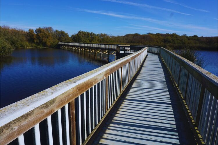
The trail begins at the Oso Flaco Lake parking lot, where you can pick up a trail map and get information about the trail conditions. The first part of the trail takes you through a shaded oak grove and then over a boardwalk that crosses a small creek. You’ll then emerge into a vast expanse of sand dunes, where you can see the ocean in the distance.
After crossing the sand dunes, the trail takes you through a wetland area, where you can see a variety of bird species. The trail then leads to Oso Flaco Lake, a freshwater lake that’s surrounded by tall grasses and cattails. The lake is a popular spot for fishing and birdwatching, and it’s a great place to take a break and enjoy the scenery.
The Oso Flaco Lake Trail is an easy hike, suitable for hikers of all ages and abilities. The trail is flat and well-maintained, with plenty of benches and rest stops along the way.


Rancho Guadalupe Dunes Preserve
Distance from Pismo Beach: 20 miles
The Rancho Guadalupe Dunes Preserve is a unique and beautiful natural area located just north of Guadalupe. This 1,400-acre preserve is home to some of the largest remaining coastal dunes in California, as well as a variety of wildlife and plant species. The preserve offers several hiking trails that allow visitors to explore this unique landscape and experience the beauty of the Central Coast.
One of the most popular hiking trails in the preserve is the Dune Ridge Trail. This 2.5-mile trail takes hikers up to the top of the dunes, offering stunning views of the surrounding landscape. The trail is moderately challenging, with a steep climb up onto the dunes and some uneven terrain. However, the views from the top are well worth the effort.
Another popular hiking trail in the preserve is the Beach Trail. This 2.5-mile trail takes hikers down to the beach, where they can walk along the shoreline and explore the tide pools. The trail is relatively easy, with a gentle slope down to the beach. However, it’s important to be aware of the tides and to stay off the dunes to protect the fragile ecosystem.
The preserve also offers a few shorter trails, including the Eucalyptus Loop Trail and the Tally-Ho Trail. These trails offer visitors the opportunity to explore the natural beauty of the preserve without committing to a longer hike.
One of the unique features of the Rancho Guadalupe Dunes Preserve is the diversity of plant and animal life that can be found here. The preserve is home to several rare and endangered plant species, as well as a variety of wildlife, including shorebirds, rabbits, and even mountain lions.
Visitors to the preserve are asked to respect the fragile ecosystem and to stay on designated trails.


More Hikes Near Pismo Beach
We have covered a good number of places to hike in Pismo Beach. But, if you are still craving more hike ideas (I do not blame you), here are some ideas around the Morro Bay and San Luis Obispo areas.
Montana de Oro State Park
Montana de Oro State Park is located just north of Pismo Beach and offers a variety of hiking trails. The park has over 8,000 acres of rugged coastline, canyons, and mountains. This is one of the most beautiful state parks in California. So make time to visit! You can thank me later.
The most popular trail in the park is the Bluff Trail, a 3 to 4 mile (depending on how far you walk) out-an-back trail that allows visitors to appreciate popular spots such as Spooner’s Cove and Corallina Cove.
The Valencia Peak Trail (another popular trail) is a 4.5-mile out-and-back trail that takes hikers to the top of Valencia Peak. The trail is considered moderate to difficult, but hikers are rewarded with stunning views of the coastline.


Point Buchon Trail
The Point Buchon Trail is a 6.6-mile out-and-back trail located just south of Montana de Oro State Park. The trail takes hikers through a rugged coastal landscape and offers stunning views of the ocean. The trail is considered moderate in difficulty.
Keep in mind you do not have to hike the entire 6.6 miles to enjoy the scenery of this trail.
Reservoir Canyon Trail
Located in San Luis Obispo, the Reservoir Canyon Trail is a 5-mile out-and-back trail that takes hikers through oak woodlands, past a waterfall, and up to a scenic overlook. The trail is considered moderate in difficulty and is open year-round.
Bishop Peak
Bishop Peak is a popular hiking destination located in San Luis Obispo. The peak is the highest in the Morros range and offers stunning views of the surrounding mountains and valleys. The trail to the top is just under four miles long and is considered moderate to difficult. The trail is well-maintained, and hikers are rewarded with breathtaking views at the top.
Irish Hills Natural Reserve
Located in San Luis Obispo, the Irish Hills Natural Reserve offers over 7 miles of hiking trails through rolling hills and oak woodlands. The trails are considered moderate in difficulty, and hikers are rewarded with stunning views of the surrounding landscape.
Location
Pismo Beach is located 81 miles from Santa Barbara, 176 miles from Los Angeles, and 244 miles from San Francisco.
By car, the city can be accessed through US-101.
The nearest airport is located in San Luis Obispo. There is an airport in Santa Barbara as well. Keep in mind these are small, regional airports. The closest Amtrak (train) station is located in Grover Beach.


Hiking in Pismo Beach Gear
I recommend taking into consideration the following gear when planning your Pismo hikes:
- Wearing the right shoes is essential when hiking or walking. I recommend investing in a good pair. Merrell shoes have always been good for my crooked feet. My husband is more of a fan of the Salomon brand.
- I take the minimum with me when I go on trails. I keep everything organized in a small crossbody bag. My husband prefers to take a light day pack.
- Hiking poles are lifesavers on trails with an incline (more if you have wobbly knees).
- I protect myself from the sun with a wide bream hat, sunscreen, lip balm, and a long sleeve tee.
- Do not forget to bring water! We pack a cold beverage or hot coffee to enjoy after a hike. The THERMOS Tumblers keep drinks hot for 7 hours and cold for over 10 hours.
- I have never gotten used to taking pictures exclusively with my phone. I prefer to use the Sony Alpha a6000. It is compact and takes gorgeous pictures.


In conclusion, Pismo Beach and the surrounding area offer a variety of hiking trails for hikers of all levels. Whether you’re looking for a quick and easy nature walk or a challenging hike, there’s something for everyone. So, grab your hiking boots and hit the trails in Pismo Beach. You won’t be disappointed!
More of Pismo Beach
Hiking in Pismo Beach is way too much fun! However, if you are interested in other activities, check out my detailed guide to things to do in the city and other cities in the county.
Shell Beach: Great Coastal Views
More of California
Los Angeles Ultimate Bucket List
Ultimate San Diego Bucket List
150+ Places to Go in Orange County
Places to Visit in Santa Barbara
Things to Do in Ventura County
Which of these hikes in Pismo Beach have you completed?


Leave a Reply