Listen up, outdoor lovers! Here are specific details about the best Laguna Beach hikes. Get ready since this city has some of the most beautiful views in Southern California.
With its incredible diversity of landscapes, hiking in California has always been of the most sublime level. If you are looking to get outdoors to seriously stretch your legs, the 20,000 acres of the pristine coastal wilderness of Laguna Beach and the state parks surrounding it have no equals.
Laguna Beach has hundreds of miles of trails. Below you will find some that ensure endless views of the Pacific Ocean, canyons, and hillsides. These will get your blood pumping for sure.
Please note: This article contains affiliate links, meaning I may earn a commission if you make a purchase by clicking a link. Of course, this comes at no extra cost to you and helps me to keep offering solid information to readers.

Table of Contents
About These Laguna Beach Trails
Laguna Beach is a city located in Orange County. It is well-known because of its numerous beaches, wild canyons, art festivals, eclectic shops, and lavish accommodations. The city is located about 25 miles from Anaheim, 80 miles from San Diego, and 50 miles from Los Angeles.
Even though the city tends to be associated with glamour, art, and creativity, the hiking opportunities are huge. And, I mean, you will be flabbergasted after you check out the beauty surrounding this place!
This article focuses on hiking Laguna Beach. I will cover a bit of hiking near Laguna Beach as well. Not all recommendations will fall within city limits. And, that makes sense since the big parks/reserves in the area extend over several cities.
Let me also say that I love to walk/hike but I am not an experienced hiker.
However, I believe Laguna Beach has something for everybody when it comes to walking and hiking. I have completed these hikes. I am not going to lie. Some have kicked my butt and left me in pain for several days. But, each drop of sweat has been worth the effort.
So, whatever your condition, I want to encourage you to go out and tackle one of these hikes in Laguna. Bring the family or a group of friends. Remember to take it easy. There is no reason to rush.
Interested in hiking in Southern California? Check out these articles.
Laguna Beach Hiking: When to Hike
Laguna Beach’s summer temperatures range from 80 to 90 degrees Fahrenheit.
Based on those numbers, I would advise hiking in Laguna Beach during spring, fall, and winter. Keep in mind your body may feel temperatures higher than what they are. Also, there is not a lot of shade in the Laguna area. You will be hiking under direct sunlight.
Another consideration is where the hiking trails are located. Coastal trails are cooler because of the ocean breeze. Inland trails will feel hotter.
If you want to hike during summer, hit the trails before or after the daily maximums (early morning or late afternoon). Or, concentrate efforts in Laguna Beach’s coastal trails.
Important Note: I recommend NOT hiking when temperatures are over 100 degrees Fahrenheit. Of course, the exception is shaded trails. Always check weather conditions before leading to a trailhead.
Laguna Beach Trails: Important Considerations
The Laguna Beach hiking trails highlighted below are located mainly in three main areas: Crystal Cove State Park, Laguna Coast Wilderness Park, Aliso, and Woods Canyons Wilderness Park.
Do you see the word “wilderness” in the names of some of those places? Yes, and let me tell you those places are wild for real. It is incredible that such places exist near an extremely populated area.
Therefore, make an effort to pay attention to your surroundings. Watch out for wildlife that can harm you (I have seen snakes and spiders). Study the trails before going on a hike. Carry a map. Inform others where you are going to be hiking.
Carry water with you at all times. Protect yourself from the sun. Follow the rules. Be smart about your moves.

Hiking Gear
Having the right gear can make your life way easier. Check out below my recommendations when it comes to hitting the hiking trails in Laguna.
- Hiking Shoes – Wearing the right shoes is essential when hiking. I recommend investing in a good pair. Merrell shoes have always been good for my crooked feet. Not long ago, I was using tennis shoes to hit the trails. That was until I hurt my left foot. Since then, hiking shoes have done wonders for me. >Check out my hiking shoes
- My husband is more of a fan of the Salomon brand when it comes to hiking. >Check out Salomon hiking shoes
- Hiking Socks – Wool hiking socks provide support, cushion, and prevent blisters. EnerWear sells an excellent 4-pair set for a good price. >Check them out here
- Insoles – Insoles are another way to protect your feet when hiking. They do a great job absorbing shock. Walk Hero’s insoles have some of the best ratings in the market. >Get them here
- Crossbody Bag – I take the minimum with me when I go on trails. I keep everything organized in a small Herschel crossbody bag. >Buy this great crossbody bag here
- Day Pack – My husband prefers to take a small backpack to carry drinks and essentials. >Buy a lightweight, water resistant day pack here
- Hiking Poles – Hiking poles are lifesavers on trails with an incline (more if you have wobbly knees). TrailBuddy’s trekking poles are such a great help. >Check these hiking poles
- Sun Block – Do not leave the house (or the car) without applying sunblock. I repeat, always wear sunblock when outdoors. >Buy sun block here
- Lip Balm with Sunscreen – Protect your lips by applying a balm with sunscreen. >Get one of the best lip balms here
- Wide Brim Hat – A wide brim hat is a great way to protect your scalp, face, and neck. The ones manufactured by FURTALK come with an anti-UV function. >Buy this amazing hat here
- Sunglasses – These are another must when it comes to protecting from the sun. A polarized, sporty pair works better for hiking. >Take a look at this wonderful pair
- Water Bottle – Do not forget to bring water! Keep yours cold by taking a beautiful Hydro Flask water bottle. >Check out the insane options her
- Snacks – It is a good idea to carry snacks such as granola bars, protein bars, trail mix, nut, and jerky
- Camera – I have never gotten used to taking pictures exclusively with my phone. I prefer to use the Sony Alpha a6000. It is compact and takes gorgeous pictures. >Buy Sony Camera here

Laguna Beach Hikes: Best Trails and Hiking Areas
Let’s get to the fun part of the article. Here’s a handpicked list of some of the best Laguna beach hikes to try on your next visit.
I am not necessarily focusing only on easy hikes in Laguna Beach. The trails here are an easy to moderate mix.
Oh, and there are so many places to hike in Laguna Beach! It was difficult to determine which ones to include in the article. I aimed for variety. If I do not cover your favorite hike, let me know in the comments section below.
Aliso Summit Trail
4 miles – 931 Feet High – 538 Feet Low
Time: 2 hours
Average grade: 3%
Dogs: Yes
Park hours: 7 am to 9 pm (March to October) and 7 am to 6 pm (November to February)
Parking: Available at Aliso and Wood Canyons. No fees.
Difficulty: Moderate (some people rate it easy)
Wildlife: If you are lucky, you might spot whales in the ocean during the migration
Nearby recommended routes: Highland Avenue connects t0 portions of the trail.
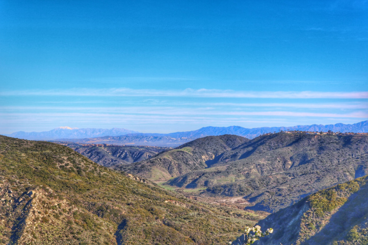
The Aliso Summit Trail makes for one of the top Laguna beach hikes. The entrance is situated at Sea View Park (near Laguna Niguel). The trail has two portions connected by Highlands Avenue. This Laguna Beach hike is basically for nature lovers and provides stunning views of the Woods Canyon and the ocean along the way.
Aliso Creek Trail
10 miles – 813 Feet High – 98 Feet Low
Time: 3 – 4 hours (you can walk/hike as much as you want)
Average grade: 3%
Dogs: Not allowed
Park Hours: 7 am till sunset
Parking: Available @$3 per vehicle daily
Difficulty: Easy to Moderate
History: This trail was part of tribal land and now the property of Orange County Parks.
Wildlife: The area is a designated wildlife sanctuary
Nearby recommended routes: Caspers Park Loop, Wood Canyon Cave Tour & San Clemente Figure 8
This is an out and back trail located near Lake Forest and is known for the beautiful wildflowers found on the route. The trail is open all year round and is good for all levels of hikes (beginner or experienced level). This is also a great place to ride bikes.
Dripping Cave Trail
5.8 miles – 400 Feet High – 249 Feet Low
Time: 2 hours
Average grade: 3%
Dogs: No
Park hours: 7 am till sunset
Parking: Small fee at the lot. Free on the street. Bathrooms are located near the parking area.
Difficulty: Easy
History: This hidden cave served as a refuge for outlaw Juan Flores, and gang, in the 1850s.
Wildlife: Lookout for mule deer
Nearby recommended routes: There are numerous side trails and loops connecting to other trails in the Laguna Coast Wilderness Park.
Nestled conveniently inside the Aliso and Woods Canyon Wilderness Park, the Dripping Cave Trail is considered to be one of the best hikes in Laguna Beach. The trail is mostly flat, well-marked, and extremely family-friendly. The exact location of the trailhead is 28373 Alicia Parkway.
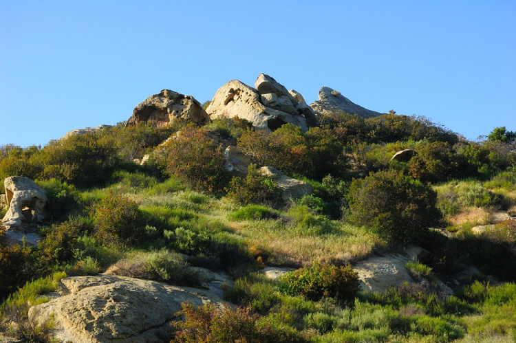
Photo by Tristan Schmurr
Seaview Park Trail
Also known as Seaview Park Overlook Trail
0.6 miles
Time: 30 minutes
Average grade: Mostly flat
Dogs: On leash
Park hours: 7 am to 8 pm
Parking: Plenty available at Talavera Drive
Difficulty: Easy to moderate
Wildlife: Be on the lookout for birds. Watch for mountain lions and rattlesnakes.
History: Accessible all year round, this is a moderately trafficked trail near Laguna Niguel.
Nearby recommended routes: Valido Trail, Aliso Peak, Badlands Park, Aliso Summit Trail
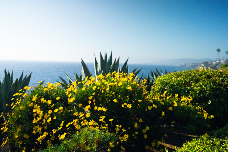
Of all the Laguna Beach hiking trails, Seaview Park Trail is a great local favorite. It provides nice views of the Pacific Ocean and the canyons from the number of benches laid out. Short and sweet, this quick hike will lead to perfection. The best way to access this trail is via Crown Valley Parkway exit on I-5. The nearby Badlands Park has an easy hiking trail as well.
Salt Creek Trail
6.8 miles – 390 Feet High – 46 Feet Low
Time: 2 to 3 hours (you can hike/walk as much as you want)
Average grade: 3%
Dogs: On leash
Hours: Trail never closes
Parking: Free at Chapparosa Community Park and Laguna Niguel Regional Park. The trail can also be accessed from Salt Creek Beach (park on the beach’s parking lot and walk towards the beach, you can also take a shuttle (golf cart) to the beach)
Difficulty: Easy
Wildlife: Apart from rabbits and the occasional snake, grass and local plants can be seen along the way.
History: Salt Creek was planned in the 1990s to serve as a corridor for hikers and bikers to link the communities on the waterway.
Nearby recommended routes: Salt Creek Beach to Strands Beach and all the way to the Dana Point Headland
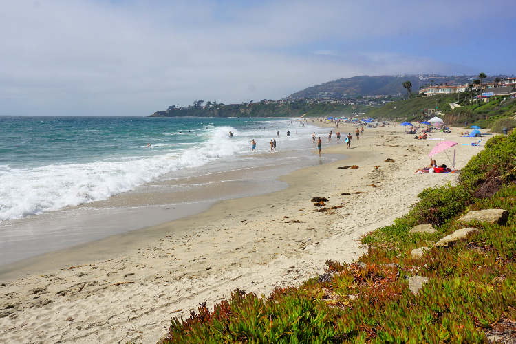
Active families and beginner hikers will enjoy this trail since it passes by four public parks and connects two coastal canyons. Kids will simply love this hike as there is an awesome beach at the end. Restroom facilities are available at the trailheads.
Barbara’s Lake Loop
3.1 miles – 390 Feet High – 374 Feet Low
Time: 1.5 hours
Average grade: 3%
Dogs: No
Park hours: 7 am to Sunset
Parking: North of Highway 73. $3 on weekdays, $5 on weekends, and $7 on holidays.
Difficulty: Easy to Moderate
Wildlife: Mule deer, long-tail weasel, and bobcats.
History: This loop trail named after Barbara Rabinowitsh, an environmentalist, passes through the only natural lake in Orange County
Nearby recommended routes: Laguna Coast Wilderness Park Loop, Aliso and Woods Canyon Loop, Willow Staging Area Loop, Veer Ranch Park, and Canyon View Park.
Barbara’s Lake is one of the most beautiful water bodies in Orange County. Situated inside the James Dilley Preserve, the easy loop trail is a nice way to get some fresh air and enjoy the breathtaking scenery. This hike is one of the best Laguna Beach Trails for nature lovers. To reach here you drive on Highway 133 till you reach the entrance to the James Dilley Greenbelt Preserve.


Lauren Canyon Trail
3.7 miles loop – 810 Feet High – 226 Feet Low
Average grade: 6%
Time: 2 hours
Dogs: Not allowed
Park hours: 7 am till sunset
Parking: Available 8 am to 5 pm @$3 per vehicle per day.
Difficulty: Moderate
History: This was a former cattle ranch called Rancho San Joaquin, which is now an area protecting endangered flora and fauna.
Wildlife: California Gnatcatcher, Cactus Wren, and Orange Throated Whiptail
Nearby recommended routes: Laurel Spur & Willow Trail Loop
The Laurel Canyon Trail begins just off the Laguna Canyon Road, parallel to Highway 133, uphill past Ghost Rock. Poison oak and ticks are common. I recommend heading to the area with closed shoes and long pants.


Bommer Ridge Trail
7.4 miles – 938 Feet High – 807 Feet Low
Time: 3 hours
Average grade: 3%
Dogs: No
Park hours: 7 am till Sunset
Parking: Free but crowded
Difficulty: Moderate to Hard, depends on where you start the hike
Wildlife: Roadrunners and rabbits jump across while hawks and vultures circle overhead. The area is a rattlesnake habitat.
Nearby recommended routes: Big Bend Trail, Laguna Ridge Trail, Moro Canyon Trails
This trail is an extension of Ridge Park Road after merging with the Crystal Cove State Park trails. This well-traveled dirt road is popular with hikers, with short ups and downs offering great views of San Joaquin Hills and beyond. You can access the trail from the Crystal Cove State Park area (end of Ridge Park Road) or Laguna Coast Wilderness Park (Big Bend Area, the Big Bend Trail connect to the Laguna Ridge Trail and the Laguna Ridge Trail connects to the Bommer Ridge Trail).


Water Tank Trail
3 miles – 853 Feet High – 269 Feet Low
Time: 2 hours
Average grade: 7%
Dogs: No
Park hours: 7 am to Sunset
Parking: Poplar Street, if you want to do the walk one way.
Difficulty: Moderate
Wildlife: Home to 40 endangered species including toads, skinks, roadrunners, and birds
History: The Laguna Coast Wilderness is 7000 acres of coastal canyons and natural lakes offering commanding views of the Pacific Ocean
Nearby recommended routes: Bandit Loop, Flagpole Hill, O’Neill Regional Park.
A visit to Laguna Beach is never complete without a hike or bike ride on the Water Tank Trail in the Laguna Coast Wilderness Park. Even if you don’t come across any wildlife, the panoramic views of the coast will blow you away. The trail is suitable for all ages and hiking levels.


Moro Canyon Trail
5 miles – 850 Feet High – 32 Feet Low
Time: 2 to 3 hours
Average grade: 4%
Dogs: No
Park hours: 6 am to sunset.
Parking: $15 flat at the Visitor Center.
Difficulty: Moderate to Hard, depends on hiker’s physical condition
Wildlife: Rattlesnakes and mountain lions. Tons of rabbits too.
History: Before it became a State Park, Crystal Cove was a trailer park. These mobile homes were finally evicted in 2006.
Nearby recommended routes: Emerald Canyon, Bommer Ridge
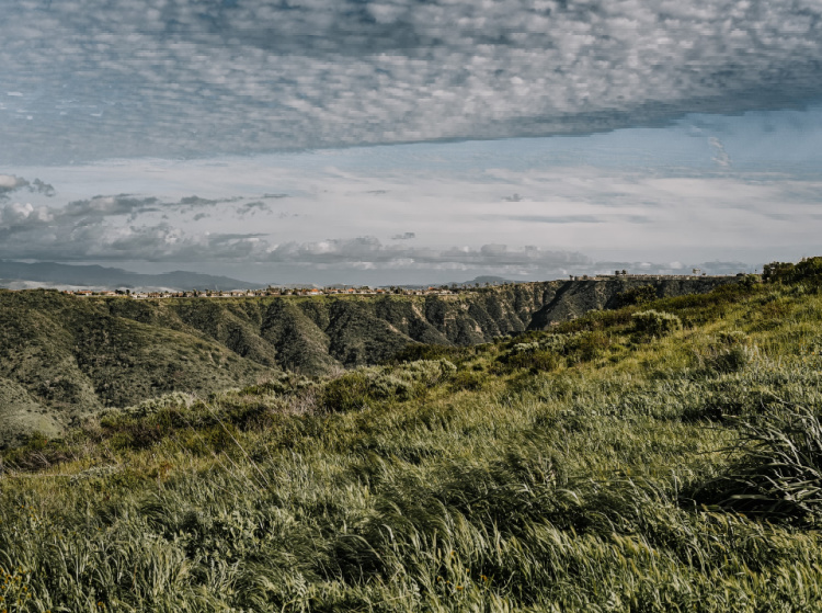
El Moro Canyon Trail is one of the great hikes near Laguna Beach for those interested in wildlife and local plants. You can start by getting details about the hike at the Visitors Center. The park can be easily accessed from the Pacific Coast Highway. There are no bathrooms on the route. Therefore, make sure you stop by one before hitting the trail.

Bluff Trail
3.2 miles
Time: 1 to 2 hours, set apart more time if you want to explore the Crystal Cove’s beaches and historic district
Average grade: Mostly flat
Dogs: No
Park hours: 6 am to Sunset
Parking: $15 flat at the Visitor Center.
Difficulty: Easy
Wildlife: Marine life and birds
Nearby recommended routes: Moro Canyon Trail, Emerald Canyon, Bommer Ridge
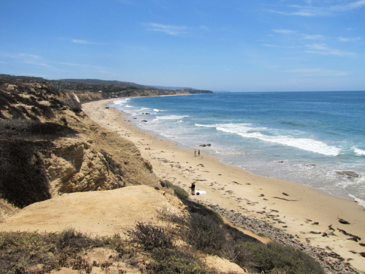
The Bluff Trail hugs the coast and offers crazy beautiful views of the Pacific Ocean. There are multiple entry points to the trail. You do not have to walk the 3 miles if you do not want to. The entire trail is unshaded, so may want to take your sunscreen along with a bottle of water and probably a hat too.
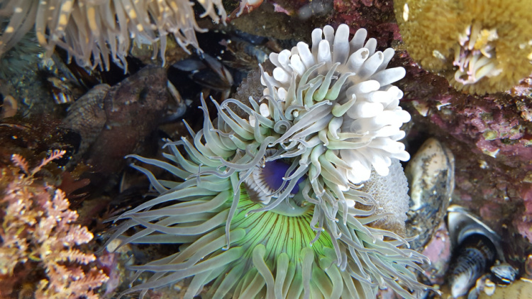
After hiking, make sure to check the beach cottages at the Crystal Cove Historic District, the tide pools, and the shakes prepared at Ruby’s Shake Shack (because we all need a shake after hiking).

Dartmoor Trail
4 miles
Time: 2 to 3 hours
Dogs: No, only service dogs
Park hours: The trail never closes
Parking: Free on the street
Difficulty: Easy to Moderate
Wildlife: Goats grazing on the plains and little critters crossing the path
Nearby recommended routes: El Moro Canyon Loop Trail, Crystal Cove Perimeter Loop, El Moro Canyon Short Loop Trail, and other trails at the Laguna Coast Wilderness Park.
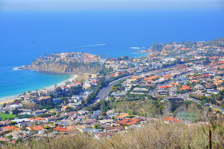
Dartmoor is a popular hike with those as it provides great looks of the coast and Downtown Laguna Beach. Enter Dartmoor Street (Laguna Beach) on the GPS and drive all the way to the end of this street. Once you reach the top of the trail, turn left and follow a short trail for even more scenic views of the coast.

Thousand Steps Beach
0.8 miles
Time: 30 minutes
Average grade: 3%
Dogs: No
Park hours: The trail never closes
Parking: Free but extremely difficult to get a spot. It is better to visit during the week.
Difficulty: Easy
Wildlife: Marine animals
History: The stairs have about 200 steps (not 1,000 as the name implies)
Nearby recommended routes: Valido Trail, Salt Creek Trail, Badlands Park, and South Laguna Trail
Situated just 2.5 miles from the town center in South Laguna, the Thousands Steps Beach is not easy to reach. One has to walk down a steep stair to reach the sand, but once you descend the climb down is worth the effort.

Top of the World
2.4 miles
Time: 1 to 2 hours
Average grade: About 800 feet gain
Dogs: On leash
Park hours: Open during sunlight hours
Parking: Free, on the street if you start at the bottom, Alta Vista Park if you start at the top
Difficulty: Easy, if you start at the top, Moderate, if you start at the bottom
Nearby recommended routes: Water Tank Trail, Carolyn Wood View Knoll, Western Ridge Trail
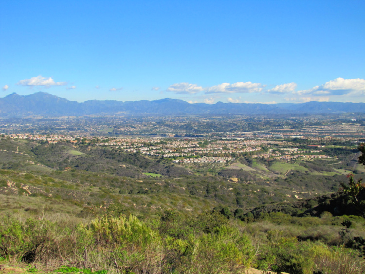
The Top of the World Trail leads to panoramic views of the Pacific Ocean, hills, canyons, Catalina Island, and even Mt Baldy. The trailhead can be found at 580 Canyon Acres Drive. Park on the street. This is a steep trail leading up.
Now, you can “cheat” your way to the top. All you have to do is drive to Alta Laguna Park. From there, you can access the trail (from the top) and walk as much as you want. Just keep in mind that the longer you go down, the harder is going to be to go back to the top.

Heisler Park
1.3 miles
Time: 1 hour, more time if you explore the beaches and coves
Average grade: Mostly flat, beaches are mostly accessed through stairs
Dogs: On leash
Park hours: Open during sunlight hours
Parking: Metered parking spots available all along the park
Difficulty: Easy
Nearby recommended routes: Dartmoor Trail, Crescent Bay
This park offers some of the most gorgeous views in Laguna Beach. The paved walkway running along the park is full of viewpoints and access to the different coves. The park itself features works of art, picnic grounds, benches, water fountains, and restrooms. It is an excellent place to spend most or part of the day. And, it is located a stone’s throw from Downtown Laguna Beach.
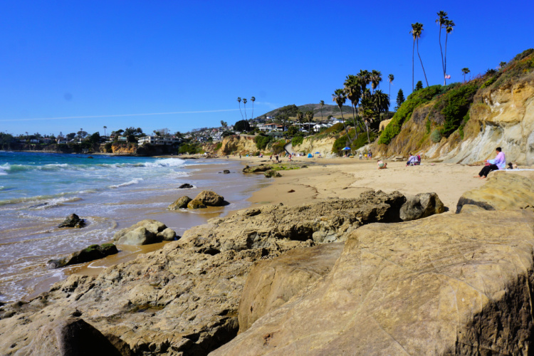

Hope you feel motivated to hit the trails after discovering these Laguna Beach hikes.
What are your recommendations in terms of Laguna Beach hikes?
Pin Best Laguna Beach Hikes for later!



Leave a Reply