Spending a couple of days on California’s Central Coast? Make sure to check out the most beautiful San Luis Obispo hikes! They will keep you busy for hours!
San Luis Obispo is a city with a unique kind of vibe.
We can attribute this to many factors but, without a doubt, location is a big part of it.
Nestled between mountains and the coast, San Luis Obispo is a haven for outdoor enthusiasts. And, one of the best ways to explore the outdoors is by taking advantage of the city’s extensive trail system.
In this article, we’ll highlight the top hiking trails in San Luis Obispo, providing essential information about each trail’s length, difficulty level, and scenery.
So, whether you’re a local or a visitor, set some time on your agenda to enjoy the following San Luis Obispo hikes.
Please note: This article contains affiliate links, meaning I may earn a commission if you make a purchase by clicking a link. Of course, this comes at no extra cost to you and helps me to keep offering solid information to readers.
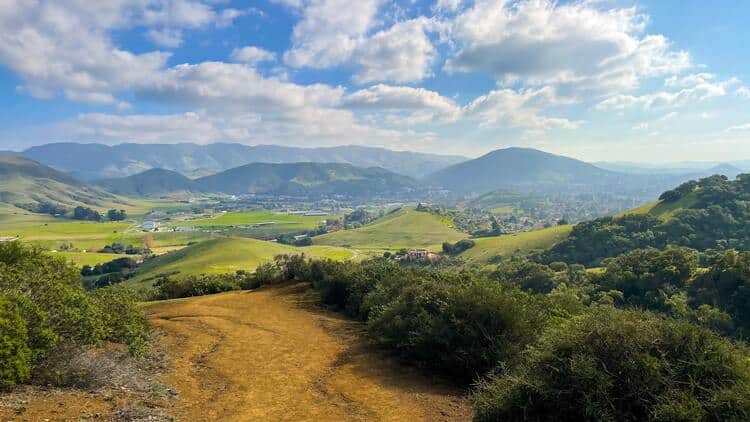
Table of Contents
Best San Luis Obispo Hikes
Most of the SLO hiking trails discussed below fall within city limits. If not, I promise they are located a few miles away from the city’s center.
Let’s take a look.
Bishop Peak Trail
Bishop Peak Trail is a stunning hike in San Luis Obispo that offers visitors the chance to explore the region’s natural beauty. The trail is moderate to difficult and has a total distance of 3.5 miles (round trip).
The distance above is calculated from the Bishop Peak Highland Trailhead. Keep in mind the top of the peak can be accessed from different trailheads (which may add distance to the total miles hiked).
During spring, the trail is particularly stunning as wildflowers begin to bloom, covering the hills in a vibrant display of color. The colorful display, paired with the sweeping views of the surrounding countryside, make Bishop Peak Trail a must-see destination for anyone visiting San Luis Obispo.
Bishop Peak is part of a series of ancient volcanic peaks that rise up from the surrounding landscape. These are known as Morros or Nine Sisters (even though experts indicate there are about 23 of these). Bishop Peak is the highest Morro.
In addition to their stunning beauty and unique geological features, the Morros in San Luis Obispo are important habitats for a wide variety of plant and animal species. The area is home to a number of rare and endangered plants, as well as several species of wildlife, including mountain lions, bobcats, and coyotes.
Fun Fact: Morro is a Spanish word that means mountain, rock, or promontory.

Photo by Sandra Foyt
Cerro San Luis Trail
If you’re looking for a great hiking destination in San Luis Obispo, you can’t go wrong with the Cerro San Luis Trail. Also known as Madonna Mountain, this is one of the notorious Morros.
The Madonna name comes from Alex Madonna, a real state developer mostly known for constructing the Madonna Inn (one of the most famous hotels in California).
This moderate to difficult level hike offers visitors a chance to explore the impressive landscape while also getting some exercise.
The 3.9-mile trail is well-maintained and easy to navigate, with plenty of shaded areas along the way to provide relief from the California sun!
There are many ways to access the trail but most people approach it from Hill Street. The hike can be extended by accessing it from the Charles A and Mary R Maino Open Space or Laguna Lake Park Open Space.
The trail is also dog-friendly, so hikers can bring their furry friends along for the adventure.
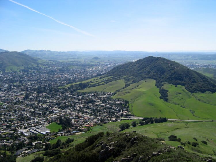


Photo by Leif Arne Storse
M Trail Loop
The M Trail Loop in Cerro San Luis Natural Reserve is a popular 2.5-mile hiking trail that offers stunning views of the surrounding hills and valleys. The trail features a moderate climb with switchbacks, leading visitors to the M-Logo made of white stones on the hillside, a symbol of San Luis Obispo.
Trailhead access is the same as described in the previous entry.
Lemon Grove Loop
The 2.2-mile Lemon Grove Loop crisscrosses the Charles A and Mary R Maino Open Space and borders part of the Cerro San Luis Natural Reserve. This moderate hike, with 300 feet of elevation gain, is a great option for those who do not want to ascend to the top of Cerro San Luis but still fancy nice vistas.
Extend the hike (and make it more challenging) by combining it with the Rock Garden Trail, the trail that takes you to the top of Cerro San Luis. This combination will yield a moderate to difficult 3.9-mile hike.
Reservoir Canyon Loop Trail
You’ll experience one of the best hikes in San Luis Obispo on the Reservoir Canyon Loop Trail. The trail is a hidden gem that winds through a lush canyon and ends with a picturesque waterfall.
The total distance of the hike is 5.4 miles, and the difficulty level is moderate. But the trail is shaded and provides a respite from the heat on hot days, so the tiresome hike is all worth it.
Along the way, hikers can explore a seasonal waterfall and a small cave. The final section of the trail leads to a scenic overlook with panoramic views of the city and the ocean beyond.
The trailhead can be found at the end of Reservoir Canyon Road. The trail can be accessed from Cuesta Canyon Park as well.


Johnson Ranch Loop Trail
With a short 3-mile route, the Johnson Ranch Loop Trail (located at the Johnson Ranch Open Space) is a relatively easy hike that offers just as much visual stimulation as the others. Hikers can enjoy the shade of lush oak trees and get a glimpse of wildflowers.
The trailhead can be found on Ontario Road. As with other trails described in the article, there is a connector to other reserves/open spaces. In this case, you can connect to the Irish Hills Natural Reserve.
Other than hikers, mountain bikers and pets are all allowed on the trail, so grab your gear and get going!
Felsman Loop Trail
The Felsman Loop Trail, partly located in the Ferrini Ranch Open Space, is a 2.4-mile moderately difficult hike that winds through oak woodlands, grassy meadows, and rocky outcrops. With splendid views of the mountains and valleys around you, the trail becomes all the more enjoyable.
The loop can be accessed from Patricia Drive. The other trailhead is located at Highland Drive. This is one of the main trailheads used to access Bishop Peak (we discussed above). Instead of continuing the Bishop Peak Trail to the top, there will be a fork, close to the trailhead, that you can take to access the Felsman Loop. Or, if you are up to the challenge, complete the Felsman Loop and then ascend to the top of Cerro San Luis (keep in mind this adds difficulty to the hike).


Islay Hill Trail
The Islay Hill Trail is a 1.5-mile loop trail (located in the Islay Hill Open Space) rated easy, making it suitable for hikers of all skill levels. The trail can be accessed from Huckleberry or Sweet Bay Lanes.
The trail starts off with a gentle incline through oak trees and grassy fields before reaching the main ascent up to the summit. This a great option for views (and photos) without having to battle the steeper summits in the area (because not all of us are experienced hikers).
A 5-acre park is located across the Open Space. It features different sports courts (basketball, volleyball, and more), a playground, and a grassy field ideal for picnics.
Irish Hills Natural Reserve
The Irish Hills Natural Reserve is a beautiful 1,100-acre reserve offering visitors an opportunity to experience a countryside with rolling hills, grasslands, and oak woodlands.
The hiking trails at the Irish Hills Natural Reserve are some of the most popular in the San Luis Obispo area. The trails vary in difficulty, with some being easy and flat while others are more challenging with steep inclines. The trails are well-maintained and offer beautiful views of the surrounding countryside.
If you are visiting for the first time, I recommend hiking a loop composed of the Mariposa, Canyon View, and Froom Creek Trails (about 3 miles, relatively easy).
You can shorten the hike by combining the Mariposa and King Trails (this will result in a shorter loop).
Or, you can extend the hike by combining the Mariposa, Poppy, Canyon View, and Froom Creek Trail.
As you can see, there are many trails in the Reserve (some are short and serve as connectors). It is advised to rely on a map or guiding device. Be careful since Google does not always show trails properly in places like this.
The Mariposa Trail trailhead can be found on Devaul Ranch Road.


Photo by Thor Liland Larsen
Laguna Lake Park Open Space
This recreational area features a lake, disc golf course, dog park, and several easy hiking trails.
For example, visitors can complete the 2-mile trail surrounding the lake. In addition, you will find the Upper Loop, Lake Side, and Allen K. Settle Trails. Combine these to create easy walking loops of 1.4 to 2 miles. If you are looking for easy hikes in San Luis Obispo, this is one of the places to check out.
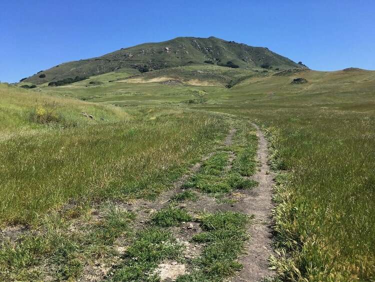

Photo by docentjoyce
Poly Canyon Trail
Most hikes in San Luis Obispo stand out because of its stunning surroundings and vistas. However, if you are looking for something different, head to the Poly Canyon Trail.
The Poly Canyon Trail offers views of Cal Poly’s campus and the surrounding hills. This 3-mile out-and-back trail is rated easy to moderate, making it suitable for hikers of all skill levels.
The trail starts off with a gradual incline through oak trees and chaparral before reaching the main ascent up to the summit. Along the way, hikers can explore old architecture, including a windmill and various buildings.
The final section of the trail leads to the iconic “Architecture Graveyard,” a collection of experimental structures built by architecture students over the years.
So, if this sounds interesting, by all means, head there.



Photo by Rob Bulmahn, CC BY 2.0, via Wikimedia Commons
Bonus: San Luis Obispo Botanical Garden
Ok, I realize a botanical garden may not fit the hiking theme but this one does. Bear with me.
The San Luis Obispo Botanical Garden covers 150 acres and is home to over 500 plant species, making it a popular destination for nature lovers and horticulturists.
The garden is divided into several sections, each with its own unique theme and plant species. Some of the most popular sections of the garden include the Mediterranean Garden, showcasing plants from the Mediterranean region, the Succulent Garden, featuring a variety of drought-tolerant succulent plants, and the Native Plant Garden, showcasing the native flora of the Central Coast.
Visitors to the garden can take a leisurely stroll along the Discovery (1.5-mile) and Panorama (3-mile) Trails that wind through the garden, enjoying the various plants and flowers along the way. There are also several guided tours available, which offer a more in-depth look at the garden’s history, plant species, and environmental importance.
Make sure to visit the website for more information.


Hikes Near San Luis Obispo: Los Padres National Forest
Los Padres National Forest is huge. Because of this, it is divided into four districts. The Santa Lucia District is the closest to San Luis Obispo.
Discussing what this District has to offer is beyond the scope of this article. If you are interested in learning more, visit this website.
I’ll give you a taste of the area by highlighting two trails.
East Cuesta Ridge or Mount Lowe Trail
The East Cuesta Ridge (or Mount Lowe Trail) is an 8-mile (round trip) hiking trail that takes hikers to the summit of Mount Lowe. This is one of the most scenic destinations in San Luis Obispo since it provides hikers the opportunity to move across the crest of the Santa Lucia Mountains. This allows for views of the county’s Morros, the Pacific Ocean, and even the sand dunes in the Pismo Beach area.
The trailhead is located off the US-101 Highway, in the Cuesta Grade area. You can Google “East Cuesta Ridge Road Parking Lot” for exact directions.
The course starts in a dense forest and winds through rocky terrain before reaching the summit, where you’ll be able to see the surrounding mountains in all their glory!
Its terrain is moderately challenging, with some steep sections and narrow paths, so prepare accordingly with sturdy shoes and hiking poles!



Big Falls Trail
The 4.5 miles long Big Falls Trail takes hikers through a picturesque canyon to a stunning waterfall. After a few miles of hiking, hikers will reach the majestic Big Falls, which is a beautiful reward for their effort.
The waterfall is approximately 50 feet tall and is surrounded by lush vegetation, making it a great spot to take a break, cool off in the refreshing pool, and take in the beautiful surroundings.
The Big Fall Trailhead is located at Upper Lopez Canyon Road. From Downtown San Luis Obispo, it is about 27 miles or an hour’s drive.
Keep in mind this is a seasonal waterfall. The prime time to visit is late winter and spring.
Hiking Around San Luis Obispo: Morro Bay
Morro Bay is one of the most unique destinations in California. It is located only 14 miles from San Luis Obispo and it is an outdoors/nature lovers’ refuge.
There is so much to see and do here. Hikers will have a feast.
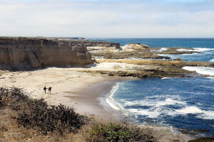
My top recommendation in the area is Montaña de Oro, a state park boasting over 8,000 acres of rugged coastline, canyons, and mountains.
The park is a must-visit destination for hikers, bikers, and horse riders, with a variety of multi-purpose trails to explore. The Bluff Trail is a particularly popular trail, spanning 3 to 4 miles (depending on how far you walk) and offering stunning views of popular spots such as Spooner’s Cove and Corallina Cove. Listen up! Do not miss this park!

Hiking Near San Luis Obispo: Pismo Beach
Pismo Beach is located about 13 miles from San Luis Obispo. So, if you want to add some awesome coastal San Luis Obispo trails to your repertoire, this is the place to go.
I have a dedicated article covering everything you need to know about hiking in Pismo Beach.
My top recommendation in the area is the Pismo Preserve, a space with 11 miles of trails spread over 880 acres of land. Hikers can enjoy amazing coastal views and explore canyons, hills, and oak woodland.
The Discovery Trail is a 5.2-mile loop that takes around 2 hours to complete, while the Spring to Spring Trail is a 3.7-mile beginner-friendly trail that takes around 1.5 hours. The Vamonos Canyon Trail is 1.3 miles long and takes 35 minutes to complete, and is recommended for families with kids.
Hiking Trails Near San Luis Obispo: Avila Beach
Last but not least, those interested in finding the best hikes in SLO, should head to Avila Beach.
The city is located only 10 miles from San Luis Obispo and it usually does not get as crowded as its more famous neighbors. My super useful article about hikes & trails in Avila Beach will help you to determine what works best for you.
I recommend not missing the views from the Cave Landing area (you can hike the Ontario Ridge or Avila Ridge Trails). The views of the northernmost point of the San Luis Obispo Bay are out of this world. This is especially true during sunset, making it a popular spot for photographers.


San Luis Obispo Hikes Gear
I recommend taking the following into consideration when planning your hikes in SLO:
- Wearing the right shoes is essential when hiking or walking. I recommend investing in a good pair. Merrell shoes have always been good for my crooked feet. My husband is more of a fan of the Salomon brand.
- I take the minimum with me when I go on trails. I keep everything organized in a small crossbody bag. My husband prefers to take a light day pack.
- Hiking poles are lifesavers on trails with an incline (more if you have wobbly knees).
- I protect myself from the sun with a wide bream hat, sunscreen, lip balm, and a long sleeve tee.
- Do not forget to bring water! We pack a cold beverage or hot coffee to enjoy after a hike. The THERMOS Tumblers keep drinks hot for 7 hours and cold for over 10 hours.
- I have never gotten used to taking pictures exclusively with my phone. I prefer to use the Sony Alpha a6000. It is compact and takes gorgeous pictures.
Location
San Luis Obispo is located 95 miles from Santa Barbara, 218 miles from Los Angeles, and 232 miles from San Francisco.
By car, the city can be accessed through US-101.
San Luis Obispo has its own airport and Amtrak (train) station. There is an airport in Santa Barbara as well. Keep in mind these are small, regional airports.


Hope you have enjoyed learning about the awesome San Luis Obispo hikes highlighted here (and about the best hikes near San Luis Obispo as well). If you are entertaining the idea of visiting the city, do not think much about it. Just go! It is going to be tons of fun!
More of San Luis Obispo
If you are interested in more than trails in SLO, check my comprehensive articles covering a wide range of destinations in the county.
Shell Beach: Great Coastal Views
More of California
Los Angeles Ultimate Bucket List
Ultimate San Diego Bucket List
150+ Places to Go in Orange County
Places to Visit in Santa Barbara
Things to Do in Ventura County
Have you completed any of the San Luis Obispo hikes in the article? Do you have additional suggestions?




Leave a Reply