Want to go on an incredible hiking trip with your friends? Check out the best Riverside hikes then!
If you’re looking for a new adventure, I recommend trying some astounding hikes in Riverside. With refreshing air and beautiful scenery, they’re a great way to unwind and rejuvenate your energy.
So if you’re ready to create memorable experiences, check out our best Riverside hikes.
Please note: This article contains affiliate links, meaning I may earn a commission if you make a purchase by clicking a link. Of course, this comes at no extra cost to you and helps me to keep offering solid information to readers.

Table of Contents
Best Riverside Hikes
Let me start by saying the hikes, or hiking areas, presented in this article are located in the city or within an 18 miles radius of the center. You should be able to reach trailheads in about half an hour.
So, let’s start taking a look at some great hiking trails in Riverside.
Sycamore Canyon Wilderness Park
Sycamore Canyon Wilderness is one of the most popular places to hike in Riverside. It’s a 1,500-acre park that has a striking view of the city. It’s also a refuge for over 100 endangered plants and animal species, such as Stephen’s Kangaroo Rat.
Overall, the Canyon has five trails, with the longest one being 5.6 miles. They are the following:
- Kelsey Trail
- Little L.O. Trail
- Winter Cabin Trail
- Dorsey Spring Trail
- Hog Hill Trail
On the upper part of the park, the trails are surrounded by Gambel oak, juniper trees, and ponderosa pine. And the lower side of Winter Cabin Trail, one of the park’s trails, features a breathtaking view of Sycamore Canyon.
It’s important to note that the canyon offers hot and dry conditions. Luckily, you can get groundwater from the springs located near the northeastern side of the Canyon. Nevertheless, you should still bring water and sun protection.
UCR Botanic Gardens Trails
At the University of California, Riverside, you will find a botanical garden with a short 1.8-mile loop trail that takes around 50 minutes to complete. The trail has three surfaces: paved, dirt, and gravel.
Keep in mind that the unpaved trails have irregular cross slopes that may be a bit rough to navigate. But overall, the trails are mostly steeped gently.
There are picnic tables, which makes it a great choice for families and friends. Also, it’s worth noting that you aren’t allowed to bring your pets.


Big C Trail
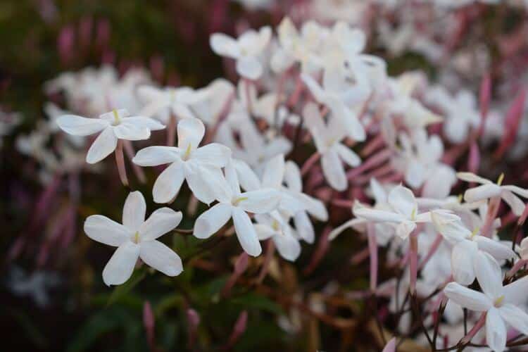
The Big C Trail is a 3.3-mile trail located near the UCR campus and offers beautiful views of the city and the surrounding hills. The trail is named after the large concrete “C” that overlooks the city and is a popular spot for photos.
The trailhead for the Big C Trail is located at the end of Blaine Street, just off the 215 freeway. From there, you will make your way up the mountain on a well-maintained trail that offers a moderate level of difficulty.
At the top of the mountain, you will be rewarded with a panoramic view of the entire region, as well as the opportunity to see the famous “C” up close. The concrete “C” was first built in 1957 by students at the nearby university, and has become a landmark of the area.


Box Springs Mountain Reserve
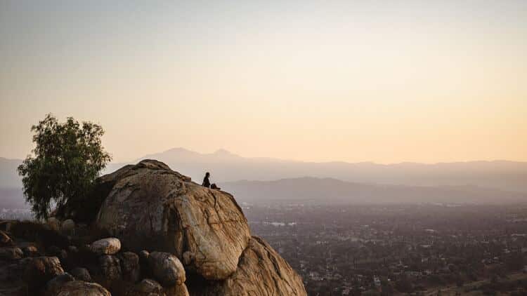
Box Springs Mountain Reserve is a 1,155-acre park located near Riverside. It has seven trails that vary in difficulty.
The reserve has a trail called Two Trees. It’s a 2.5-mile trail with a 977 feet elevation gain that many hikers favor because of its moderate difficulty and the beautiful scenery it offers.
If you are interested in other trails, you can try out the reserve’s Box Springs Mountain Loop, which boasts a 4.6-mile long trail and an 892 feet elevation gain.
Box Springs Mountain Reserve’s other trails include:
- The M Hike
- Edison Loop Trail
- Table Mountain Loop
Also, you can find picnic spots in the parking area, which makes the reserve a good choice for families.
Harford Springs County Park
Harford Springs County Park is a 325-acre park with diverse wildlife, including lizards, snakes, and birds.
It has way less foot traffic than most popular trails in Riverside. This makes it a great choice if you want to escape the hustle and bustle of urban cities.
However, there is not a lot of information about the trail system in the park. My recommendation is to visit the Riverside County Parks website and download the park’s map to your phone (as a PDF). In that way, you can orient yourself.
This is a great place to visit during spring when wildflowers are in bloom.


Pumpkin Rock Trail
For those looking for a quick and fun hike, Pumpkin Rock Trail fits the bill.
From its name, the trail has a 15-foot-high rock, painted as a carved pumpkin, on top of the hill—perfect for Halloween! You can even bring your dogs as long as they’re on a leash.
This trail is quite popular, so you should expect heavy foot traffic, especially during the festive seasons.
The trail is mainly uphill and takes around an hour to complete. If you get tired on the way back, you can take a second path that’s more gradual.
Hidden Valley Wildlife Area
The Hidden Valley Wildlife Area spans about 1,000 acres and is home to a diverse range of wildlife and habitats.
The wildlife area provides access to 25 miles of hiking trails. If you visit, you will be able to observe stunning views of the surrounding mountains and a unique blend of ecosystems, including riparian, coastal sage scrub, and grasslands.
One of the highlights of the Hidden Valley Wildlife Area is its extensive wetlands, which provide important habitat for several bird species, including the American coot, great blue heron, and snowy egret.
You can access the hiking trails from Arlington Avenue or Pedley Substation Road. Or, you can access the trails from the Hidden Valley Nature Center.
Mount Rubidoux Trail
The Mount Rubidoux Trail is one of the most popular hiking trails in Riverside. It’s a moderately steep 3.2-mile trail that takes around an hour and a half to complete. It’s also paved and suitable for mountain biking.
The trail will take you to the top of Mount Rubidoux, where you can enjoy stunning views of the city below. Once at the top, you can also explore the Peace Tower and the Cross, both of which offer historical significance to the area.
You can bring along your furry friend, but you should put him on a leash.
It’s important to note that you might struggle with finding a parking area at the trailhead. Be patient since there are always hikers coming and going.


Citrus Interpretive Trail
The Citrus Interpretive Trail, located at the California Citrus State Historic Park, is one of the shortest Riverside hiking trails. It’s a 1.25-mile short loop trail that takes no more than 30 minutes to finish. As you might’ve guessed, the trail is surrounded by orange, lemonade, and grapefruit trees.
The trail has light traffic and is a great choice for bird-watching. Along the trail, there are signs that go over the area’s agricultural heritage, which history buffs will enjoy.


Lake Evans Trail
Fairmount Park is a beautiful park located in the heart of Riverside. The park is situated on over 100 acres of land and offers a variety of recreational opportunities for visitors of all ages.
One of the main attractions of Fairmount Park is Lake Evans, a large man-made lake that is perfect for fishing, boating, and picnicking. The lake is stocked with a variety of fish, including trout, catfish, and bass, making it a popular spot for anglers. Visitors can also rent paddle boats and enjoy a leisurely ride on the lake.
A 2.8-mile loop winds around Lake Evans, offering beautiful views of the water and the surrounding park. The trail is relatively flat and easy, making it a great option for families and beginners.
Note: You can combine a visit to Fairmont Park with Mount Rubidoux since these are adjacent.
Mount Jurupa
The trail to the summit of Mount Jurupa is about 3.6 miles round trip and has an elevation gain of about 1,200 feet. The trail is well-maintained and considered moderate in difficulty. The trail is also dog-friendly, so visitors can bring their furry friends along for the hike.
As hikers make their way up the trail, they will be surrounded by a diverse range of plant and animal life. The mountain is home to several species of birds, including hawks and eagles, and visitors may also spot coyotes and other wildlife.
Once you reach the summit of Mount Jurupa, you will be rewarded with stunning views of the surrounding mountains and valleys. On a clear day, you can see as far as the Pacific Ocean and the San Gabriel Mountains. The summit also offers a great spot for a picnic or to simply take in the natural beauty of the area.
Let me mention the trail I am describing above is the trail that accesses the summit from the south. You can take a trail from the north side and complete the hike in 2.5 miles (super steep trail though).
You may want to visit the Jurupa Mountains Discovery Center after the hike. One of the center’s main attractions is the outdoor dinosaur exhibit, which features life-size dinosaur sculptures and provides visitors with a chance to learn about these ancient creatures and their role in the earth’s history. The center also features a butterfly garden, a bird aviary, and a reptile house.


Skyline Trail
The Skyline Trail is a popular hiking trail located in the city of Corona.
The trail is approximately 10 miles long and begins at the Skyline Trailhead, located at the end of Foothill Parkway. The trail is well-maintained and clearly marked, making it easy to navigate even for those who are new to hiking.
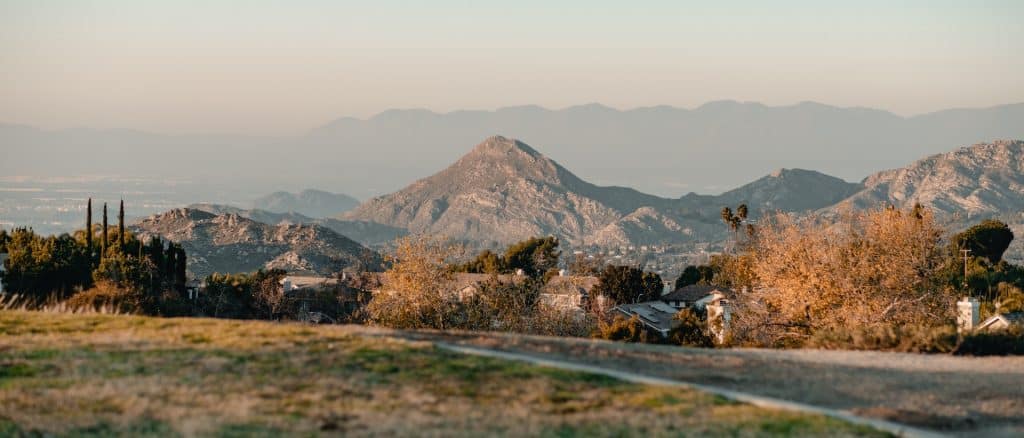
As you make your way along the Skyline Trail, you will be treated to sweeping views of the Santa Ana Mountains, as well as panoramic views of the surrounding cities and valleys.
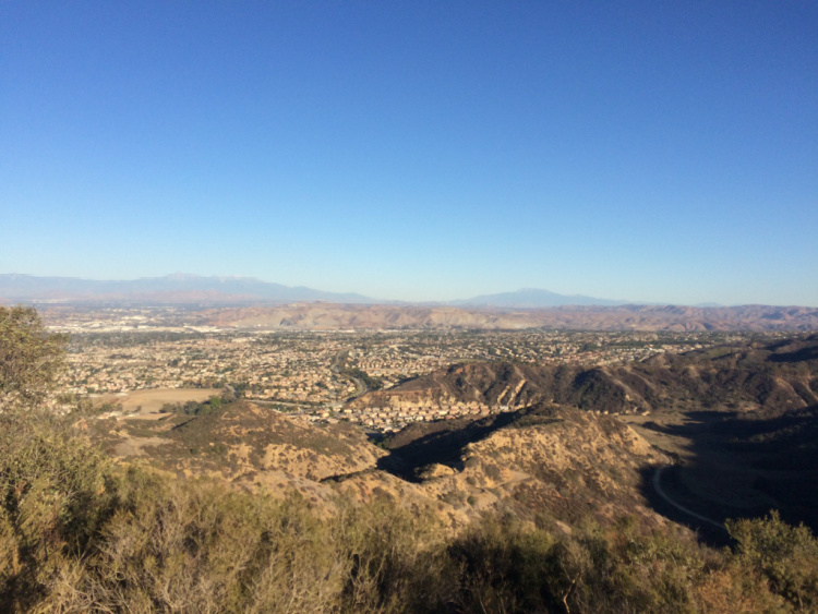

Photo by Sergei Gussev
Hikes Near Riverside
If you’re looking to explore beyond Riverside, there are several great hikes within a short drive of the city. Here are a few hiking trails near Riverside that are worth checking out:
Big Falls Trail
Distance from Riverside: 35 miles
This 1.2-mile trail is located in Forest Falls, in the San Bernardino National Forest. The trail leads to a 500-foot waterfall, making it a popular spot for hikers and photographers alike. The trail is relatively easy, but it can be steep in some sections.
You can combine a visit to the area with other hikes in the forest or hikes in Yucaipa Regional Park, or Wildwood Canyon State Park. Another option is to spend some time in beautiful Redlands. The Downtown area is gorgeous!
Read More: Things to Do in Redlands
San Jacinto Peak
Distance from Riverside: 51 miles
Located about an hour’s drive from Riverside in the San Jacinto Mountains, this hike offers stunning views of the Coachella Valley and the surrounding mountains. The hike is challenging, with a 10,834-foot summit, but the views are well worth the effort.
If you are looking for something less difficult, head to Mount San Jacinto State Park and hike the Ernie Maxwell Scenic Trail.


Mount Baldy
Distance from Riverside: 40 miles
Located about an hour and a half’s drive from Riverside in the San Gabriel Mountains, Mount Baldy offers a challenging hike with stunning views of the surrounding landscape. The summit is at 10,064 feet and offers panoramic views of the Inland Empire, Los Angeles, and the surrounding mountains.


Cucamonga Peak
Distance from Riverside: 40 miles
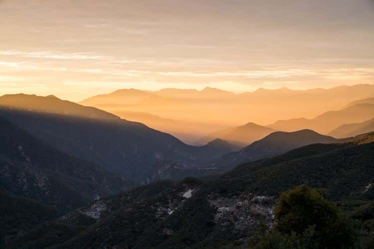
Located about an hour’s drive from Riverside in the San Gabriel Mountains, Cucamonga Peak offers a challenging hike with stunning views of the surrounding landscape. The summit is at 8,859 feet and offers panoramic views of the Inland Empire and the surrounding mountains.
Lake Arrowhead
Distance from Riverside: 35 miles
Located about an hour’s drive from Riverside, Lake Arrowhead offers several great hikes, including the Pacific Crest Trail and the Heart Rock Trail. The Heart Rock Trail is a relatively easy 1.7-mile hike that leads to a heart-shaped rock formation and a small waterfall.
Palm Springs Aerial Tramway
Distance from Riverside: 55 miles
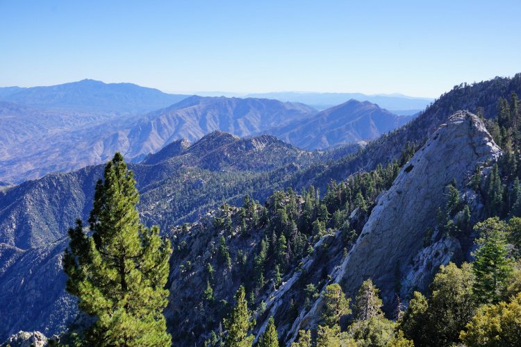
Located about an hour’s drive from Riverside, the Palm Springs Aerial Tramway offers access to several great hikes in the San Jacinto Mountains. The tram takes visitors from the desert floor to an elevation of 8,516 feet, where they can explore a range of hiking trails, including the Round Valley Loop Trail and the San Jacinto Peak Trail.


Riverside Trails – Hiking Gear
I recommend taking into consideration the following when planning your Riverside hikes:
- Wearing the right shoes is essential when hiking or walking. I recommend investing in a good pair. Merrell shoes have always been good for my crooked feet. My husband is more of a fan of the Salomon brand.
- I take the minimum with me when I go on trails. I keep everything organized in a small crossbody bag. My husband prefers to take a light day pack.
- Hiking poles are lifesavers on trails with an incline (more if you have wobbly knees).
- I protect myself from the sun with a wide brim hat, sunscreen, lip balm, and a long sleeve tee.
- Do not forget to bring water! We pack a cold beverage or hot coffee to enjoy after a hike. The THERMOS Tumblers keep drinks hot for 7 hours and cold for over 10 hours.
- I have never gotten used to taking pictures exclusively with my phone. I prefer to use the Sony Alpha a6000. It is compact and takes gorgeous pictures.
Location
Riverside is a city located in the Inland Empire region of Southern California. It is situated approximately 60 miles east of Los Angeles and 50 miles west of Palm Springs. The city is easily accessible by car, with several major highways passing through the area, including Interstate 215, State Route 60, and State Route 91.
If you’re coming from Los Angeles, the easiest way to get to Riverside is by taking Interstate 10 east and then switching to Interstate 215 south. This route will take you through the San Bernardino Valley and offer stunning views of the surrounding mountains. If you’re coming from San Diego, you can take Interstate 15 north and then switch to State Route 60 east.
If you prefer to travel by public transportation, Riverside is served by the Riverside Transit Agency (RTA), which offers bus service throughout the city and the surrounding area. The city is also home to the Riverside-Downtown Metrolink Station, which offers commuter rail service to Los Angeles and other cities in the region.


When to Hike
Before we close out this article about hiking in Riverside, we need to discuss the weather.
In the summer months, Riverside can get very hot, with temperatures often reaching into the 90s and occasionally even over 100 degrees Fahrenheit. It is obvious that this is not the time to hike. Please, this is serious, do not attempt to hike under these weather conditions.
In the winter months, temperatures in Riverside typically range from the mid-40s to mid-60s Fahrenheit, with occasional rain and fog. This is a good time to hike but keep an eye on weather reports (rain can cause trail closure).
During the spring and fall, temperatures in Riverside are mild and comfortable, with highs in the 70s and 80s Fahrenheit. These seasons are generally considered the best for outdoor activities.
Hope you have enjoyed this article showcasing the best places to hike in Riverside! Happy hiking!


More Hikes in Southern California
Best Hiking Trails in Laguna Beach
More of California
Los Angeles Ultimate Bucket List
Ultimate San Diego Bucket List
150+ Places to Go in Orange County
Places to Visit in Santa Barbara
Let me know, what are your favorite Riverside Hikes?


Leave a Reply